In the past year, several changes have influenced volcano hikes in Indonesia:
-
Periodic temporary trail closures due to increased volcanic activity monitoring
-
Enhanced visitor management systems at major sites
-
Stricter daily climber limits on selected mountains
-
Expanded digital registration systems for park entry
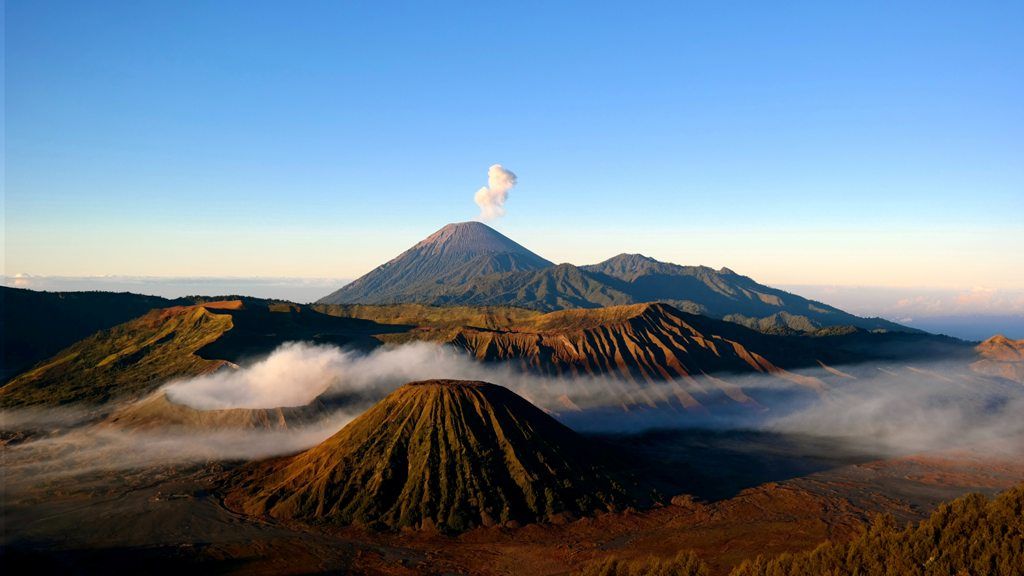
For example, Mount Rinjani introduced regulated entry quotas to reduce overcrowding and preserve trail conditions. At Mount Bromo, visitor traffic has been managed more carefully during peak sunrise viewing hours.
Another trend involves improved safety awareness at sulfur-rich volcanoes such as Mount Ijen, where hikers often use protective masks due to volcanic gases.
Technology has also played a role. Government monitoring agencies regularly publish volcanic alert levels. These updates influence hiking accessibility and evacuation readiness.
The graph below illustrates general visitor flow patterns during dry versus rainy seasons:
| Season | Trail Accessibility | Typical Visitor Volume |
|---|
| Dry Season | High accessibility | Higher visitor numbers |
| Rainy Season | Slippery terrain | Reduced activity |
Seasonal planning is essential because weather impacts trail safety, visibility, and overall hiking conditions.
Laws and Policies Governing Volcano Hikes
Indonesia volcano hikes are regulated under national park and environmental protection laws. Many major volcanoes are located within protected conservation areas managed by the Ministry of Environment and Forestry.
Key regulatory aspects include:
-
Mandatory entry permits for national park access
-
Registered guide requirements for certain peaks
-
Restricted zones based on volcanic alert levels
-
Environmental protection rules prohibiting littering or damaging ecosystems
For example, Mount Semeru, located in Bromo Tengger Semeru National Park, operates under strict entry limits to reduce erosion and environmental degradation.
Volcanic activity is monitored by Indonesia’s geological authorities, which assign alert levels. When alert levels rise, hiking routes may close for safety reasons.
These policies aim to balance tourism with risk management and conservation. Travelers should always check official advisories before planning a trek.
Tools and Resources for Planning Volcano Hikes
Effective preparation improves both safety and overall hiking experience. The following tools and resources support responsible volcano trekking:
Planning Tools
-
Topographic hiking maps
-
GPS navigation apps for trekking routes
-
Volcanic activity monitoring platforms
-
Weather forecasting apps
-
Travel insurance comparison tools
Safety Equipment Checklist
-
Proper hiking boots with grip
-
Headlamp for pre-dawn climbs
-
Protective mask for sulfur areas
-
Warm layers for summit temperatures
-
Emergency contact plan
Below is a simple preparation matrix:
| Preparation Area | Recommended Action |
|---|
| Route Planning | Review trail elevation and difficulty |
| Physical Fitness | Train for steep ascents |
| Permits | Confirm registration requirements |
| Emergency Preparedness | Share itinerary with contacts |
Educational resources such as geological research publications and environmental awareness programs also provide context about Indonesia’s volcanic systems.
Frequently Asked Questions
What is the safest volcano to hike in Indonesia?
Safety depends on current volcanic activity levels. Mountains like Mount Bromo are often considered accessible due to shorter trails, but hikers must always verify official alerts before visiting.
Do volcano hikes require a guide?
Some national parks require licensed guides, especially for multi-day treks such as Mount Rinjani. Regulations vary by location and current safety conditions.
Are Indonesia volcano hikes suitable for beginners?
Certain trails are beginner-friendly, while others involve steep climbs and high altitude. Researching trail difficulty and physical preparation is essential.
What are volcanic alert levels?
Alert levels indicate the level of volcanic activity. Higher alert levels may restrict access to summit areas. Monitoring agencies update these classifications regularly.
Is it safe to hike near active volcanoes?
Hiking near active volcanoes can be safe when authorities permit access and conditions are stable. However, volcanic environments are unpredictable, so compliance with safety advisories is critical.
Conclusion
Indonesia volcano hikes combine geological significance, environmental education, and outdoor adventure. With more than a hundred active volcanoes, the country offers diverse trekking experiences, from sunrise viewpoints to challenging summit climbs.
Responsible planning, awareness of regulations, and respect for local ecosystems are essential for safe participation. Government monitoring systems and conservation policies aim to reduce risks while protecting fragile volcanic landscapes.
As outdoor travel continues to grow in popularity, volcano hiking in Indonesia remains a compelling example of how nature, science, and sustainable tourism intersect. By understanding trail conditions, safety protocols, and environmental impact, hikers can approach these mountains with knowledge and preparedness rather than assumption.
Indonesia’s volcanoes are powerful natural formations shaped by tectonic forces. Exploring them through informed and responsible trekking provides both educational insight and appreciation for one of the world’s most dynamic landscapes.