Theodolite Machine Basics: A Beginner’s Guide to Surveying Equipment and Uses
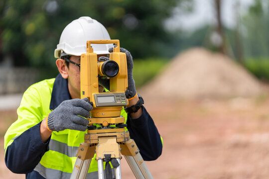
A theodolite is a precision instrument used in surveying to measure horizontal and vertical angles. It plays a crucial role in construction, mapping, engineering, and geodesy. The equipment is essential when accuracy in angle measurement is necessary for planning and layout of roads, buildings, tunnels, and more.
Originally developed in the 16th century, theodolites have evolved from optical-based instruments to modern digital versions that integrate with GPS, laser rangefinders, and computer software. Whether used in large-scale infrastructure projects or small property boundary assessments, theodolites remain a foundation of accurate land measurement.
Why Theodolites Matter in Today’s World
Theodolites are essential across many industries, especially where precise measurements are critical. Here’s why theodolites are still relevant:
-
Infrastructure Development: Roadways, bridges, and railways require exact alignment and leveling achievable only with precise angle measurements.
-
Construction Planning: Construction companies depend on theodolites for accurate layout of structures.
-
Land Surveying: Property boundaries, legal plots, and development zoning are defined using data gathered by theodolites.
-
Environmental Studies: Geologists and scientists use theodolites to study landslides, volcanic activity, and terrain changes.
-
Defense and Aerospace: Theodolites are also used in missile guidance testing and military applications.
Problems it Solves
-
Prevents construction errors due to misalignment
-
Enables accurate land division and ownership documentation
-
Supports safe and reliable infrastructure design
-
Helps comply with government regulations for zoning and planning
What’s New in Theodolites? Recent Developments and Trends
Over the past few years, theodolites have seen several innovations to improve ease of use, data integration, and accuracy:
Key Updates from 2023–2024
-
Digital Theodolites with Bluetooth & USB: New models from brands like Topcon, Leica, and Sokkia now allow real-time data transfer to tablets and laptops.
-
Laser-Integrated Models: Advanced theodolites use laser plummets for improved precision in vertical alignment.
-
Software Integration: Theodolites now work with CAD (Computer-Aided Design) and GIS (Geographic Information Systems) tools.
-
Cloud Syncing Capabilities: Cloud storage and remote access for survey data are becoming common in 2024 models.
-
AI-Powered Analysis: Some modern survey instruments are introducing AI features for error reduction and terrain interpretation.
These upgrades have made theodolites more intuitive, even for beginners, while increasing the speed and accuracy of fieldwork.
How Laws and Regulations Affect Surveying Equipment Use
Using theodolites in professional surveying is subject to national and local regulations, particularly in land documentation and construction.
Common Regulatory Aspects
| Regulation Type | Details |
|---|---|
| Surveyor Licensing | Most countries require land surveyors to be licensed professionals. |
| Land Registration Laws | Data collected must align with cadastral (land boundary) requirements. |
| Urban Planning Codes | Surveys must follow government zoning, height, and boundary codes. |
| Equipment Calibration | In some regions, professional instruments must be periodically certified. |
Failure to comply with these standards can lead to legal challenges or project delays. Thus, theodolite users especially in construction and land development—must be familiar with applicable regulations.
Useful Tools and Resources for Surveying and Theodolite Use
Whether you're a student, professional, or curious beginner, the following tools can help you understand and operate a theodolite more efficiently:
Apps and Digital Tools
-
Theodolite App (iOS) – A virtual theodolite for angle measurement using your phone’s camera
-
AutoCAD Civil 3D – For processing data from digital theodolites into engineering plans
-
GeoMeasure App – Handy for GPS-based measurement in combination with theodolite work
-
Total Station Simulator – Training app for survey instruments including theodolites
Online Resources and Templates
-
Surveying Tutorials on YouTube – Channels like “Surveying with Raju” or “Engineering Stream” offer visual demos
-
Government Websites – Such as India’s Survey of India or the U.S. National Geodetic Survey
-
Survey Data Templates – Excel formats for field data recording (available on engineering student forums)
-
PDF User Manuals – Download manuals directly from manufacturer websites like Topcon or Leica
Popular Theodolite Brands
| Brand Name | Known For |
|---|---|
| Leica | Precision optics and long-term reliability |
| Topcon | Affordable digital models with great features |
| Sokkia | User-friendly interface for professionals |
| Nikon | Great for both beginners and experts |
Frequently Asked Questions (FAQs)
What is the main purpose of a theodolite?
A theodolite measures both horizontal and vertical angles accurately. It is commonly used in surveying, construction layout, and mapping projects.
How is a theodolite different from a total station?
While both are used for surveying, a total station combines the functions of a theodolite and an electronic distance measurement (EDM) tool. A theodolite only measures angles, whereas a total station measures angles and distances digitally.
Can beginners use a digital theodolite?
Yes, many entry-level digital theodolites are designed for beginners. They come with simple menus, auto-calibration, and on-screen guides. However, basic understanding of angle measurement is still needed.
Is it legal to conduct your own land survey with a theodolite?
This depends on your location. In many countries, land surveys for official or legal purposes must be conducted by licensed professionals. DIY surveys are usually not accepted in property disputes or government registrations.
How do you read a theodolite?
Traditional theodolites use graduated circles and scopes, while digital versions show angle values on a screen. Measurements are taken by aligning the scope with a target object and noting the displayed angle.
Final Thoughts
The theodolite is a timeless yet evolving tool in the world of surveying. From ancient land measurement to modern city planning, it serves as the backbone of precision in physical space design. With today’s digital upgrades and software compatibility, theodolites are more accessible than ever to students, engineers, and builders alike.
Understanding its basics can open the door to deeper exploration of surveying science, civil engineering, and geographic planning. As long as accuracy remains crucial in the physical world, theodolites will continue to play a central role quietly shaping the structures and spaces around us.